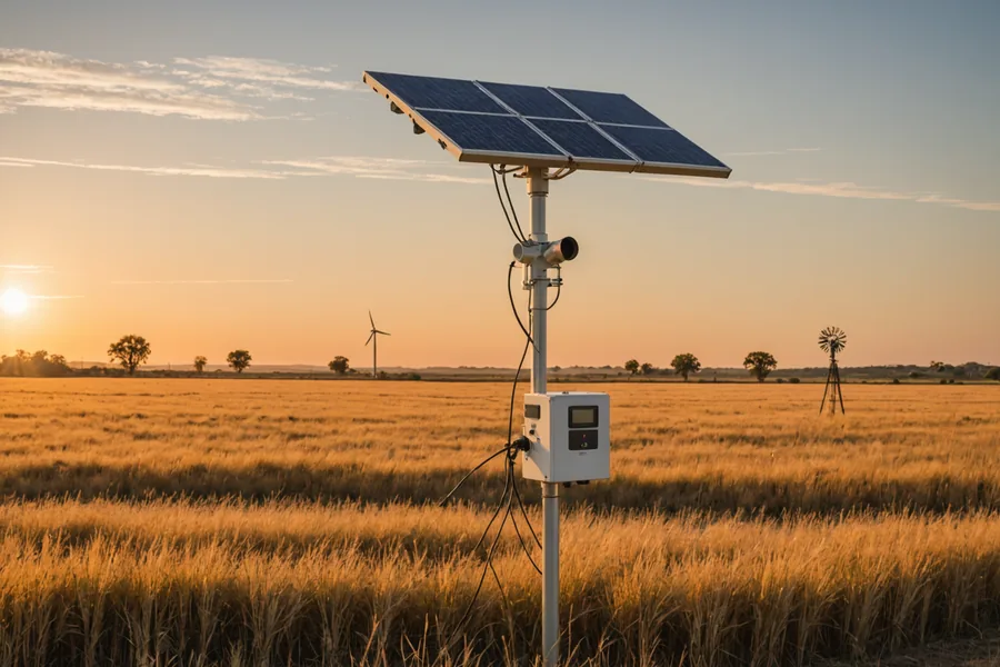
The NOAA Cooperative Observer (Co-op) Network is the backbone of all Riskwright agricultural drought trigger calculations. With more than 8,700 active reporting stations across the continental US, the headline number sounds like comprehensive national coverage. But the number that actually matters when designing a parametric policy is not the national total — it's the count of quality stations within 15–25 miles of your specific operation, with records long enough and clean enough to support a reliable SPI-3 calculation.
What the Co-op Network Actually Is
The Cooperative Observer Network is a volunteer-based observing network administered by NOAA's National Weather Service. Observers — typically farmers, ranchers, airport operators, and state employees — record daily precipitation and maximum/minimum temperature using calibrated instruments provided by NOAA. Observations are submitted electronically or manually and assembled into the daily climate record at NCEI. The network has been operating continuously in various forms since the late 19th century, giving the Co-op dataset historical depth that no satellite or radar product can yet match.
This volunteer structure has real implications for data quality. Observer turnover affects record continuity. Station relocations — moving the rain gauge 200 meters to a different exposure — can introduce systematic biases in the historical record. Observer training and equipment calibration vary. A station with a nominally complete 50-year record may contain intermittent periods of degraded data quality that require careful screening before use as a policy reference.
Station Density: The Regional Picture
Co-op station density varies substantially by region. The Northeast and upper Midwest tend to have the highest agricultural station density, with inter-station spacing of 10–18 miles in farming areas. The Southeast — the primary market for Riskwright's agricultural coverage — has intermediate density: roughly 18–28 miles average spacing in most agricultural counties, with notable gaps in forested or sparsely farmed areas.
For SPI-3 drought trigger design, the critical question is not absolute station spacing but precipitation spatial autocorrelation at the relevant distance. In the Southeast, precipitation anomaly correlation at 20–25 miles in the growing season is typically in the range of 0.75–0.85 — meaning two stations that distance apart will show broadly similar SPI readings during regional drought events. This supports workable parametric trigger design at the typical Southeast station spacing, though with higher residual basis risk than would exist at 10-mile spacing.
The spatial correlation assumption breaks down in specific geographic contexts. Along the Fall Line (the geological boundary between the Piedmont and Coastal Plain), precipitation patterns can diverge significantly within 20 miles during certain synoptic setups. In areas with complex topography — the western Carolinas and North Georgia highlands — elevation-driven precipitation gradients can produce very different station readings within the same county. In these areas, we pay particular attention to the specific relative positions of the station and the insured operation before finalizing station selection.
Record Length and Data Completeness Screening
SPI-3 calibration requires fitting a gamma probability distribution to the historical record of 3-month precipitation accumulations at the reference station. The statistical stability of this fit depends on sample size. With 30 years of data, the fit is reasonable but has meaningful uncertainty in the tails — the extreme percentiles (5th and below) that typically define agricultural policy trigger thresholds. With 50 years, tail estimation improves substantially. With 70+ years, the distribution fit for the tail percentiles is relatively stable.
We require a minimum of 30 years of usable data for a station to be considered as a primary reference station; 45+ years is strongly preferred. Many Southeast Co-op stations have records extending back to the 1940s and 1950s, providing good historical depth. We prefer station records that include at least three recognized severe drought years for the region — this confirms the historical distribution fit includes real extreme events, not just interpolated tail behavior.
Completeness screening identifies gaps, outliers, and quality flag issues in the historical record. Stations with more than 5% missing observations in the candidate period are excluded as primary reference stations — gaps introduce uncertainty into the distribution fit. Stations with documented sensor changes or relocations are evaluated on a case-by-case basis: where the relocation was minor and the historical record was homogenized by NCEI, we may retain the station with a note in the backtesting disclosure. Where relocation introduced a documented precipitation bias, we exclude the pre-relocation period from the calibration record.
ASOS vs. Co-op: Different Networks for Different Triggers
Not all NOAA stations are the same. For wind trigger design, we use the Automated Surface Observing System (ASOS) network rather than the Co-op network. ASOS stations are fully automated, staffed no observation required, and located primarily at airports and FAA facilities. There are approximately 900 ASOS stations nationally, compared to 8,700+ Co-op stations — substantially sparser spatial coverage.
ASOS's advantage over Co-op is in measurement types and temporal resolution. ASOS records wind speed (1-minute sustained and 3-second peak gust) at high temporal frequency throughout the day. Co-op stations typically record only daily precipitation total and max/min temperature — not wind. For wind parametric trigger design, ASOS is the only viable source; Co-op stations simply don't record what we need.
ASOS stations also record pressure, visibility, cloud ceiling, and temperature, which are useful inputs for supplementary analysis but not typically direct parametric trigger parameters. Their airport-centric locations mean ASOS coverage in rural Southeast agricultural areas is sparse — the nearest airport ASOS station may be 30–40 miles from a given farm, which creates the basis risk challenges discussed in our wind trigger design article.
What Sparse Station Coverage Means for Your Policy
When an operation is located in a relatively sparse station area, the underwriting process explicitly accounts for this. If the nearest quality Co-op station is 28 miles away, we calculate the expected reduction in spatial correlation at that distance and reflect it in the basis risk disclosure. We may recommend a multi-station average design using two or three surrounding stations rather than a single-station trigger, accepting modestly more complex monitoring in exchange for reduced spatial mismatch risk.
For a small number of locations — particularly in western North Carolina hill counties and isolated farm operations in the Georgia wiregrass region — the combination of station distance, topographic complexity, and record quality issues may mean we cannot design a parametric product with acceptable basis risk at any reasonable premium level. In those cases, we say so directly rather than offer a product that is unlikely to serve the client's needs. The data has to support the product.