Wind speed trigger design for infrastructure assets requires more precise parameter specification than agricultural drought triggers, and the consequences of getting it wrong are more immediate. A drought index trigger that fires a week late costs the policyholder some precision. A wind trigger calibrated to the wrong measurement type may result in a major storm event that doesn't register at all, or in frequent false positives during routine convective activity.
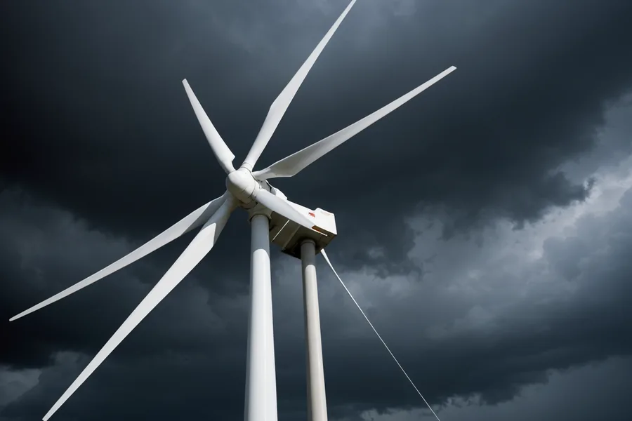
Sustained Wind vs. Peak Gust: Why the Distinction Matters
NOAA ASOS stations record two distinct wind speed measurements that serve fundamentally different analytical purposes. Maximum sustained wind speed is the highest observed 1-minute average wind speed during the observation period, calculated by averaging the anemometer output over 60 consecutive seconds. Peak gust speed is the highest observed 3-second average, designed to capture brief extreme loading events.
The relationship between sustained and gust speeds is not constant. In the outer bands of a tropical cyclone, peak gusts typically run 25–35% higher than maximum sustained speed. In convective squall lines, the ratio can exceed 40% as turbulent downburst winds produce brief extreme gusts against a moderate sustained background. For trigger design, this variability matters: a policy written against peak gust thresholds behaves very differently across storm types than one written against sustained thresholds.
Matching the Measurement to the Asset
Asset type determines which measurement type is the appropriate trigger parameter. For transmission infrastructure — towers, conductor spans, and substations — structural fatigue and galloping conductor events are driven by sustained wind loading. The relevant engineering standard, ASCE 7, specifies design wind speeds for structural loading, but transmission tower failure modes are predominantly sustained loading phenomena. For parametric trigger design, sustained wind correlates better with actual transmission tower damage claims data than peak gust in our portfolio analysis.
For solar PV arrays and tracker systems, the failure mode is different. Panel racking and tracker hardware is typically rated to sustained wind speeds in the 90–110 mph range for utility-scale systems. But the connection hardware — fasteners, clips, and guy-wire anchor points — is subject to instantaneous peak loads from gust cycling. Field damage surveys from Southeast storms consistently show racking connection failures at sites where sustained wind stayed below design rating but peak gusts exceeded it by 15–20%. For solar assets, peak gust is the technically correct trigger parameter.
For communication towers and light-gauge steel structures, peak gust is also the appropriate trigger: buckling and connection failures in these systems are driven by instantaneous peak loading, not sustained loading averages.
Threshold Calibration for Infrastructure
Once the measurement type is established, threshold calibration proceeds from the asset's engineering specifications. A solar farm with racking rated to 90 mph sustained and 110 mph peak gust has a natural anchor point for threshold discussion. The parametric policy threshold is typically set 10–15 mph below the design specification — not at the specification itself. This gap serves an important function: it captures events where speeds approach the design limit, creating operational stress even if catastrophic failure doesn't occur. Emergency inspection mobilization, precautionary tie-down operations, and response crew staging all have real costs that justify a payout even when no panel has failed.
For the Southeast solar fleet, we typically calibrate thresholds in the range of 65–80 mph peak gust for coverage targeting tropical system exposure. For transmission infrastructure in the same region, sustained wind thresholds in the range of 55–70 mph are more common, reflecting both the lower threshold for conductor galloping and the higher replacement cost of tower damage that warrants early operational response.
ASOS Station Selection: The Basis Risk Problem
ASOS stations are located at airports and military airfields, spaced 20–50 miles apart in the Southeast. This spacing introduces a more acute basis risk challenge for wind triggers than Co-op stations do for drought triggers. Precipitation anomalies have spatial autocorrelation across tens of miles. Wind speed during a storm event can vary dramatically over a few miles, particularly near coastlines, topographic features, and the landfall zone of a tropical system.
For assets within 15 miles of an ASOS station, single-station trigger design is generally acceptable. The spatial wind field correlation at that distance is sufficient for most trigger purposes. For assets 15–30 miles from the nearest ASOS station, we recommend either a multi-station weighted average design — typically using two or three surrounding ASOS stations with weights inversely proportional to distance — or a higher coverage limit to account for the residual spatial basis risk.
Assets more than 30 miles from any ASOS station present a genuine underwriting challenge. In these cases, we evaluate whether supplemental on-site anemometer data can be incorporated under an agreed data protocol at binding. This is more common for large utility-scale solar facilities that already have operational weather stations as part of their performance monitoring infrastructure. Where no quality wind data exists within acceptable proximity, we decline to write wind parametric coverage rather than produce a product that is structurally likely to miss real events.
A Scenario: Southeast Solar Farm, Tropical Event
A plausible example illustrates the design decisions in practice. A 150 MW utility-scale solar facility in coastal South Carolina carried a peak gust parametric policy for the 2023 hurricane season — coverage window June 1 through November 30, threshold 75 mph peak gust, limit $1.2M. The primary ASOS station at a regional airport 12 miles southwest of the facility was designated as the reference station, with a backup airport ASOS station 28 miles north specified for cases where the primary station's data was unavailable.
In early September, a tropical system made landfall near the Georgia-South Carolina border. The reference ASOS station recorded a peak gust of 78.3 mph during the overnight passage. Trigger confirmation was issued the following morning when NOAA's data pipeline finalized the observation. Settlement data package and wire arrived within 72 hours — covering emergency inspection mobilization, field crews that spent four days securing racking hardware, and advance payment on time-sensitive tracker component procurement. The traditional property insurance claim for physical damage was still being assessed several months later.
Event Definition and Seasonality
One specification detail that affects infrastructure wind policy design: how is a trigger event defined when a system lingers over an area for multiple days? Standard wind parametric policies define a trigger event by the observation period — typically the highest reading within a 24-hour calendar window. A slow-moving tropical system producing sustained threshold exceedance for 48 hours counts as one trigger event unless the policy contract specifies otherwise.
We're not saying multi-event structures are inappropriate — for infrastructure operators with high exposure to systems that may stall near the coastline, they warrant consideration. These specify separate payout amounts for each observation period where threshold is crossed, up to an annual aggregate limit. The premium for multi-event structures is higher; the appropriate choice depends on the operation's exposure geography and historical storm track data for that latitude band. Standard single-event policies are suitable for most Southeast infrastructure portfolios where tropical systems typically make landfall and move inland within 24–36 hours.